The Four Long Trails and the Best Hong Kong Day Hikes
Hong Kong's best day hikes, from Dragon's Back to Lion Rock, and how to survive the humidity.
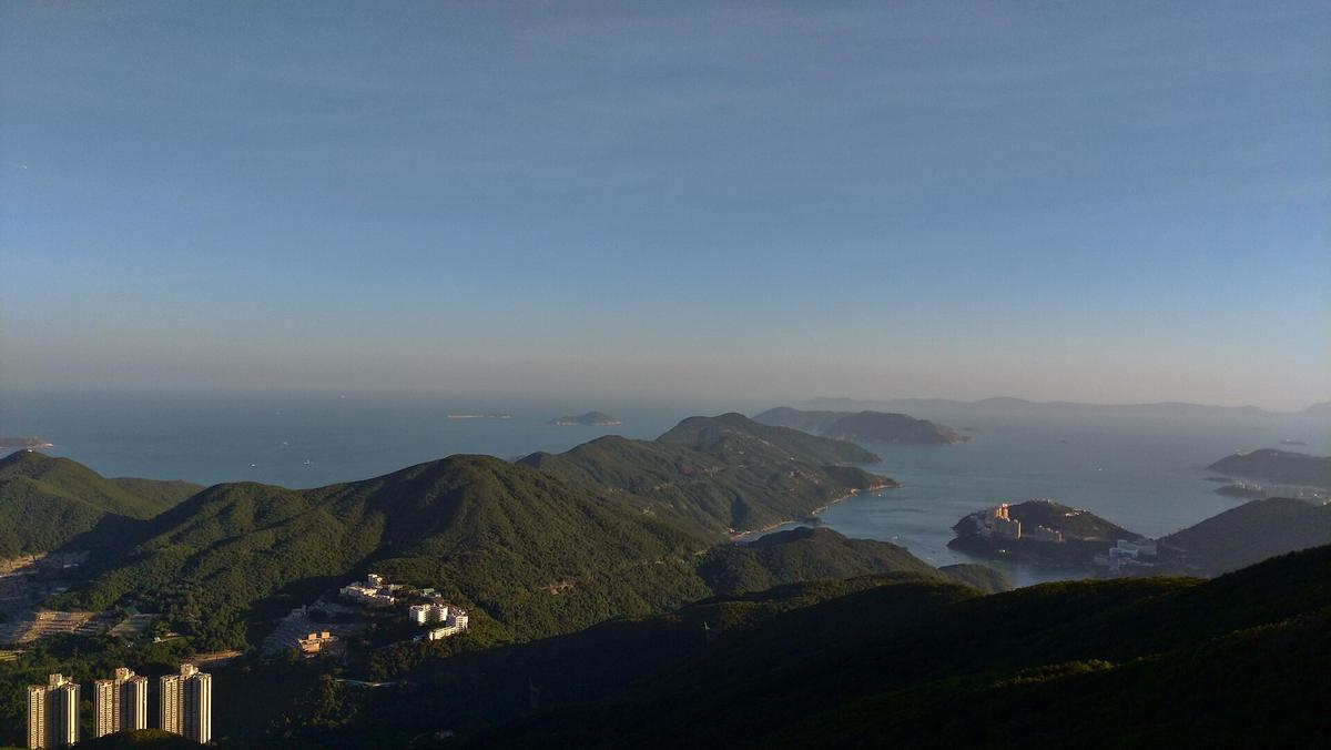

Hong Kong’s Four Long Trails and the Heat That Catches People
You have read about Hong Kong as a vertical city of neon and escalators, but you have not read about the moment the humidity pins you to a ridge with no shade and the trail markers stretch to infinity. The four long trails are the backbone of the territory's 44,300 hectares of country parks, covering roughly 40 percent of Hong Kong's land. The deciding factor is not distance. It is the wet-bulb globe temperature, the water you did not carry, and the false belief that a city this efficient could also be this physically punishing. Knowing which sections are worth your single day and how to survive the heat matters because the trail cannot help you.
The Four Long Trails and Your Best Day Options
Hong Kong has four designated long distance trails. The MacLehose Trail runs 100 kilometres across the New Territories in ten sections, with markers M001 to M200 every 500 metres. The Wilson Trail covers 78 kilometres in ten sections, markers W001 to W137. The Hong Kong Trail covers 50 kilometres across Hong Kong Island in eight sections, markers H001 to H100. The Lantau Trail covers 70 kilometres in twelve sections, markers L001 to L139. Together they cross 24 country parks, 22 special areas, 41 campsites, and roughly 100 barbecue sites. You do not need a permit to hike any of them.
You will not hike any of them end to end on a short trip. The question is which single section gives you the most reward for your single day. The answer depends on your tolerance for exposed ridgelines and direct sun.
Dragon's Back: The Reliable First Hike
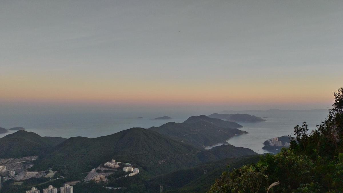
Dragon's Back is Hong Kong Trail Section 8, roughly 8.5 kilometres, rated Easy, and takes 2.5 to 3.5 hours. It is the most famous day hike in the territory for a reason. The trail runs along an exposed ridge with views of Shek O beach, the South China Sea, and the distant islands. The start is a 30 minute bus ride from Shau Kei Wan MTR station. The finish drops you into the village of Shek O, where you can eat and catch a bus back. Recommend this hike to anyone who wants a postcard view with moderate effort. The catch is that it has almost no shade. Start by 07:30 between May and September. Carry a minimum of two litres of water. The 8.5 kilometres feels short until the sun is overhead.
Lion Rock: The City View That Punishes You
Lion Rock is MacLehose Trail Section 5, roughly 5 kilometres, rated Moderate, and takes 3 to 4 hours. The trail ascends steeply to the famous lion shaped summit, giving you a direct view across Kowloon and Hong Kong Island. The approach from Wong Tai Sin MTR station is fast, under 20 minutes to the trailhead. The summit is completely exposed. The descent on the other side takes you to Tai Po Road, where you can catch a bus. Do this hike on a clear day only. If the Hong Kong Observatory has issued a Very Hot Weather Warning, skip it entirely. The 5 kilometres does not capture the vertical gain or the heat radiating off the rock.
Sunset Peak: The Lantau Classic for Experienced Hikers
Sunset Peak is Lantau Trail Section 2, roughly 9 kilometres, rated Moderate to Hard, and takes 4 to 5 hours. It is the second highest peak in Hong Kong after Tai Mo Shan at 957 metres. The trail starts near Pak Kung Au, reachable by bus from Tung Chung MTR station. The route crosses open grassland with no shelter. The views across Lantau Island and the South China Sea are the best of any trail on this list. The difficulty comes from the relentless exposure and the distance between water points. There is no potable water on the trail. Fill up at the trailhead. A three litre minimum is not excessive. Attempt this only in the cool season from October to December, when the average temperature is 15 to 22 degrees Celsius and the air dries to 60 to 75 percent relative humidity.
Sharp Peak: The Hardest Section Worth The Risk
Sharp Peak is approached via MacLehose Trail Section 2 from Pak Tam Au, roughly 12 kilometres, rated Hard, and takes 5 to 6 hours. It is the steepest peak in the territory, requiring a scramble on loose rock near the summit. The trailhead is in Sai Kung, which is 45 to 60 minutes from Central by MTR and minibus. The route passes through Sai Kung East Country Park and includes a beach crossing at Ham Tin Wan. This is not a trail for first time visitors. It is not a trail for anyone hiking in the wet season from May to September. The heat index on the exposed southern slope can exceed 33 degrees Celsius with 95 percent relative humidity. The descent is as dangerous as the ascent. If you hike it, carry four litres of water, start before 06:00, and check the Mountain Rescue coordination number (999) before you lose signal. Mobile phone coverage is patchy in the valleys.
Tai Mo Shan: The Summit You Can Drive Partway
Tai Mo Shan is MacLehose Trail Section 8, roughly 10 kilometres, rated Moderate, and takes 4 to 5 hours. At 957 metres, it is the highest point in Hong Kong. The practical advantage is that a road reaches the upper slopes, so you can start the hike at altitude and avoid the lowest, hottest stretch. Take bus 51 from Tsuen Wan MTR station to the Tai Mo Shan Road stop. The summit is often cloud covered and significantly cooler than the city below, but the trail is exposed above the treeline. This is the best option for a hot day because the temperature at the top is often 5 to 8 degrees cooler than Central. Do not rely on finding water on the trail. There are standpipes at some campsites but no guarantee they are operational.
How the Heat Changes Every Decision
The average summer temperature range is 28 to 33 degrees Celsius. The average relative humidity range is 80 to 95 percent. The Hong Kong Observatory issues a Very Hot Weather Warning when conditions reach a dangerous threshold. The Wet Bulb Globe Temperature (WBGT) threshold for suspending strenuous exercise is 30 degrees Celsius. You cannot trust your body to tell you when you have crossed that line because the humidity prevents sweat from cooling you.
The one metric that matters is the distance between trail markers. Every 500 metres on the long trails has a post. On a cool day in October, with 60 percent relative humidity and 20 degrees Celsius, a two hour section feels like exercise. On a July afternoon with 33 degrees and 90 percent relative humidity, the same distance can induce heat exhaustion. The difference is not your fitness. It is the environment.
Carry a minimum of 1.5 litres of water per hour of hiking in summer. The country parks removed litter bins from most trails. There is no one handing out water. There are no drinking fountains on the trails. Standpipes exist at some campsites but the water is not guaranteed potable. The Agriculture, Fisheries and Conservation Department operates the Enjoy Hiking app, which shows water points, toilet locations, and campsite bookings. Download it before you leave. The alternative app Hiking Trail HK from the Hong Kong Hiking Meetup Group works offline and includes trail descriptions.
Typhoon Signal No. 8 or above closes country park facilities. The Black Rainstorm Warning suspends all outdoor activities. Both can arrive with less than two hours notice during the May to September wet season. Check the Hong Kong Observatory forecast the morning of your hike. If the signal is hoisted, the trail will be empty and the ground will be dangerous. Do not test it.
What To Carry And What To Skip
Carry a local SIM or eSIM with data. Free public Wi-Fi exists in MTR stations but is inconsistent on the trails. Google Maps works. MTR Mobile or Citymapper is more reliable for routing and service updates on the way to the trailhead. Pack a light layer because air conditioning on buses and the MTR is aggressive even in summer. Pack sun protection, a hat, and electrolyte tablets. Skip the hiking boots for Dragon's Back and Lion Rock; trail runners are sufficient. For Sharp Peak and Sunset Peak, boots with good grip are non negotiable.
City to Trail: Faster Than You Expect
Hong Kong is a dense, humid, vertical city where the street life, finance towers, and hiking ridges sit within minutes of each other. The MTR runs every 2 to 4 minutes. An Octopus card or contactless payment is mandatory because many buses and minibuses require exact change. The Airport Express takes 24 minutes from the airport to Hong Kong Station or Kowloon Station. From Central, you can reach the Dragon's Back trailhead in 40 minutes via bus. From Tsim Sha Tsui, you can reach the Lion Rock trailhead in 25 minutes via MTR. The city to trail transfer time is shorter than the queue for the Peak Tram on a weekend.
This speed is the trap. Because the trail is so close, you assume you can treat it like a city park. You cannot. The trails are real mountain terrain. The country parks cover 44,300 hectares. The 41 campsites are real campsites. The 6 visitor centres are real visitor centres. The terrain does not care that you are only hiking for three hours.
The Air Conditioning Problem
The aggressive air conditioning in Hong Kong compounds the risk. You step from a 22 degree MTR carriage into 33 degree heat and 90 percent relative humidity. Your body has not adjusted. The thermal shock can cause dizziness within minutes. The common tourist mistake is to cool down fully indoors, then rush outside and start climbing. The safer approach is to spend 10 minutes in the shade outside the station before you start. Let your body find the outdoor temperature gradually.

| Trail Name | Difficulty | Distance (km) | Duration (h) | Exposure Level |
|---|---|---|---|---|
| Dragon's Back (HT Sec 8) | Easy | 8.5 | 2.5 to 3.5 | High |
| Lion Rock (MT Sec 5) | Moderate | 5 | 3 to 4 | Very High |
| Sunset Peak (LT Sec 2) | Moderate-Hard | 9 | 4 to 5 | Extreme |
| Sharp Peak (MT Sec 2) | Hard | 12 | 5 to 6 | Extreme |
| Tai Mo Shan (MT Sec 8) | Moderate | 10 | 4 to 5 | High |
Who Hong Kong’s Day-Hike Trails Suit and Who Should Stay in the City
Hong Kong’s day-hike trails are for urban explorers who want to leave the city on a fast MTR ride and climb a ridge before lunch. They are for hikers and outdoor enthusiasts who value city to trail convenience and who treat the 44,300 hectares of country parks as a serious training ground. They are for solo travellers who need a safe, well marked trail with no park entry fee and excellent public transport connections. They are for food travellers who want to earn a seafood dinner in Sai Kung or a charcoal claypot rice in Tsuen Wan.
Hong Kong’s day-hike trails are not for someone looking for a relaxed beach holiday, a cheap Southeast Asian escape, or a quiet cultural immersion without physical effort. They are not for hikers who refuse to check the Hong Kong Observatory forecasts or who assume the trail will be shaded. They are not for anyone who plans to hike between May and September without carrying three litres of water, electrolyte tablets, and a charged phone with the Enjoy Hiking app installed.
Common Questions
Which Hong Kong hiking trail is best for a first-time visitor?
Dragon's Back, which is Hong Kong Trail Section 8. It is 8.5 kilometres, rated Easy, takes 2.5 to 3.5 hours, and ends at a beach. Start by 07:30 in summer and carry two litres of water.
Do I need a permit to hike in Hong Kong country parks?
No permit is needed for any of the four long trails or standard country park hiking. A camping permit is required for designated campsites and must be booked through the AFCD online system.
What months are too hot for hiking in Hong Kong?
May to September. Average temperatures range from 28 to 33 degrees Celsius with 80 to 95 percent relative humidity. The best months are October to December when temperatures drop to 15 to 22 degrees and relative humidity falls to 60 to 75 percent.
Where can I find water on the trails?
There is no potable water on most trails. Standpipes exist at some campsites and picnic sites, but the water is not guaranteed drinkable. You must carry all the water you need. A minimum of 1.5 litres per hour in summer is the safe guideline.
Which app should I use for trail navigation?
The official Enjoy Hiking app from the Agriculture, Fisheries and Conservation Department shows trail markers, water points, toilets, and campsite availability. The alternative Hiking Trail HK app works offline and includes community trail descriptions.
What emergency number should I call on the trail?
999. The Hong Kong Police Force and Fire Services Department coordinate mountain rescue. The Government Flying Service can be reached at +852 2302 8212 or via VHF Channel 16.
Can I hike after a typhoon or rainstorm warning?
No. Typhoon Signal No. 8 or above closes country park facilities. The Black Rainstorm Warning suspends all outdoor activities. Both warnings can arrive with little notice during the wet season.
Read next
-
 Hong Kong Expat Cost of Living Broken Down by Lifestyle Tier
Real annual costs for expats in Hong Kong: budget, comfortable, and premium tiers covering rent by district, school fees, domestic helpers, and flights home.
Hong Kong Expat Cost of Living Broken Down by Lifestyle Tier
Real annual costs for expats in Hong Kong: budget, comfortable, and premium tiers covering rent by district, school fees, domestic helpers, and flights home.
-
 How to Set Up Your Finances When You First Arrive in Hong Kong
Open the right bank account, set up Octopus and FPS, and avoid costly transfer fees. A practical money setup guide for new arrivals in Hong Kong.
How to Set Up Your Finances When You First Arrive in Hong Kong
Open the right bank account, set up Octopus and FPS, and avoid costly transfer fees. A practical money setup guide for new arrivals in Hong Kong.
-
 Mobile Plans, SIM Cards and Connectivity Costs for Expats in Hong Kong
Compare 3HK, SmarTone, and CMHK mobile plans for Hong Kong expats. Monthly costs, data tiers, prepaid vs contract, and tips on staying connected abroad.
Mobile Plans, SIM Cards and Connectivity Costs for Expats in Hong Kong
Compare 3HK, SmarTone, and CMHK mobile plans for Hong Kong expats. Monthly costs, data tiers, prepaid vs contract, and tips on staying connected abroad.
-
 Where Hong Kong Expats Actually Spend Their Evenings and Weekends
How expats in Hong Kong actually spend their free time. Hiking groups, waterfront bars, beach clubs, and the Happy Valley racing ritual with real costs.
Where Hong Kong Expats Actually Spend Their Evenings and Weekends
How expats in Hong Kong actually spend their free time. Hiking groups, waterfront bars, beach clubs, and the Happy Valley racing ritual with real costs.